
Accra is the capital and largest city of Ghana, a coastal metropolis on the Gulf of Guinea that serves as the country's political, economic, and administrative hub. As the seat of national government and the anchor of the Greater Accra Metropolitan Area, the city is central to Ghana's identity and its connection to the global economy. This guide provides an authoritative overview of Accra's history, geography, people, economy, and key institutions.
Location
History
Accra's origins trace back to the 15th century, when it was a small fishing settlement along the coast. The area was part of the Kingdom of Accra, which ruled from its capital at Ayawaso. European contact began early, with Portuguese, Dutch, Danish, and British forces all recognizing the strategic value of the Gold Coast shoreline. The Portuguese established a presence in the 16th century, though local inhabitants destroyed a Portuguese fort in 1576, after which trade was conducted on the beaches.
By the 17th century, European powers had built several forts in the area. The British built James Fort, the Dutch built Fort Crêvecoeur (later known as Ussher Fort), and the Danes built Fort Christiansborg. These forts became the nuclei of separate settlements: Jamestown, Usshertown, and Christiansborg, respectively. Over time, these distinct communities merged to form the city of Accra.
The 19th century brought significant political change. Britain gradually acquired the interests of other European countries, beginning in 1851 when Denmark sold Christiansborg and its other forts to the British. The Netherlands was the last to sell its holdings in 1871. In 1877, at the end of the second Anglo-Asante War, Accra replaced Cape Coast as the capital of the British Gold Coast, a decision influenced by Accra's drier climate.
As the administrative center of the Gold Coast, Accra grew rapidly. British colonial administrators and European settlers moved into areas such as Osu, Ministries, Ridge, Labone, and Cantonments. The city's boundaries expanded in 1908 following a bubonic plague epidemic, leading to the creation of Adabraka as a native-only neighborhood to relieve congestion in the city center. By the 1920s, improved transportation links with inland cities allowed cocoa to become Accra's largest export, and commerce overtook government as the primary driver of the city's economy.
Accra played a pivotal role in Ghana's independence movement. In 1948, a boycott of European goods, sparked by rising prices for essential commodities, was organized by the chief of Osu Alata, Nii Kobina Bonney III. After Kwame Nkrumah became Ghana's first Prime Minister in 1957, he pursued an ambitious development plan for Accra, creating public spaces designed to inspire pride and nationalism. In 1961, under Nkrumah's leadership, Accra officially became the capital of the new Republic of Ghana.
Geography
Accra is located on the southern coast of Ghana, along the Gulf of Guinea, which is part of the Atlantic Ocean. The city lies within the Greater Accra Region and is part of the Ghanaian Coastal Plain. The official elevation is 61 meters (200 feet) above sea level, and the city operates on Greenwich Mean Time (UTC+00:00).
The administrative geography of Accra is complex and has evolved over time. The Accra Metropolitan District, which is under the jurisdiction of the Accra Metropolitan Assembly, covers 20.4 square kilometers and is the only district within the capital granted city status. However, the name "Accra" is also commonly used to refer to a larger territory that existed before 2008, when the Accra Metropolitan District covered 199.4 square kilometers. This larger territory has since been split into 13 local government districts: 12 independent municipal districts and the reduced Accra Metropolitan District. This broader urban area serves as the capital of Ghana and contained approximately 1.78 million inhabitants at the 2021 census.
The city is part of the larger Greater Accra Metropolitan Area (GAMA), which extends beyond the city limits and includes neighboring districts. The metropolitan area is inhabited by about 4 million people, making it one of the largest urban agglomerations in Africa.
As a coastal city, Accra is vulnerable to the impacts of climate change and sea level rise. Population growth has put increasing pressure on coastal areas, and drainage infrastructure is particularly at risk. This has implications for livelihoods, especially in informal settlements. Inadequate planning regulation, law enforcement challenges, and coordination issues among government departments have been identified as impediments to developing Accra's drainage infrastructure.
The city has a tropical savanna climate, characterized by distinct wet and dry seasons. Temperatures remain relatively consistent throughout the year, with average daily maximums around 31°C and minimums around 24°C. The city experiences a major wet season from April through July, with a secondary wet period in September and October. Annual precipitation averages approximately 800 millimeters.
People and Culture
The name "Accra" is derived from the Akan word "Nkran," meaning "ants," a reference to the anthills seen in the countryside around the city. The name specifically refers to soldier ants and was applied to the town and its people by Twi speakers. In the local Ga language, the city is called "Ga" or "Gaga," the same name as the Ga people themselves. Historian Carl Christian Reindorf confirmed this etymology, linking the martial qualities and migratory behavior of local ants to those of the Ga people. The Ga used the reference to dark-red swarming ants to connote their military prowess and their ancient conquest of Guang speakers residing in the Accra Plains.
Accra's population is young and diverse. According to demographic data, 56% of the city's population is under 24 years of age. The gender distribution is slightly skewed toward females, who make up 51% of the population, reflecting a nationwide trend.
The city's cultural landscape is shaped by its history as a meeting point of indigenous traditions, European colonialism, and pan-African aspirations. The Tabom community, descendants of Afro-Brazilian returnees, is a distinctive cultural group in Accra. The Brazil House, located on Brazil Lane in the Ga Mashie area, is considered the most expressive material symbol of the Tabon people and their heritage.
Accra hosts numerous cultural events and festivals throughout the year. The Homowo festival, celebrated by the Ga people, is one of the city's most significant traditional observances. The city also has a vibrant arts scene, including graffiti art along walls in areas such as Jamestown and at Kinbu Senior High School.
Economy
Accra is the economic hub of Ghana and the country's main connection with the global economy. The World Bank estimated in 2008 that Accra's economy constituted around US$3 billion of Ghana's total gross domestic product. The city is a center for manufacturing, marketing, finance, insurance, and transportation.
The financial sector in Accra is substantial, incorporating a central bank, commercial banks, development banks, merchant banks, discount houses, a home finance mortgage bank, building societies, the Ghana Stock Exchange, foreign exchange bureaus, finance houses, insurance companies, and real estate developers. The tertiary service sector is the city's largest employer, followed by the secondary sector, which includes manufacturing, electricity, gas, water, and construction.
According to the 2010 census, approximately 35% of total employment in the metropolis was in the wholesale and retail industry, compared to a national average of 12.3%. Manufacturing employment in Accra was 14%, higher than the national average of 8.9%. An estimated 74% of the working population in Accra is employed in the informal economy, which includes small-scale enterprises, food vendors, and street hawkers. More females (82.9% of all those employed) than males (64.7%) work in the informal economy.
The official unemployment rate in the Accra metropolis was 7.2% according to the 2010 census, higher than the national average of 5.8%, though this figure likely underestimates underemployment and other forms of labor market precarity.
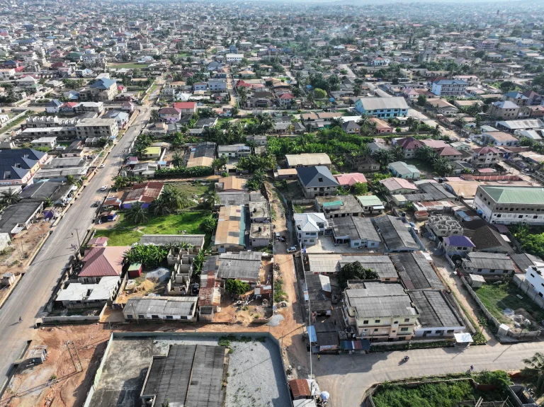
Accra faces significant urban development challenges, including inadequate and inequitable access to services and infrastructure, weak coordination of planning among local government units, and limited state responsiveness to citizens. The city has a substantial housing deficit, with an estimated 58% of the population living in informal housing. In Old Fadama, one of the largest informal settlements in the metropolis, more than 80,000 individuals live at extremely high densities.
The Accra Metropolitan Assembly (AMA) is the local government authority responsible for the city. It is one of 261 Metropolitan, Municipal and District Assemblies (MMDAs) in Ghana and among the 29 MMDAs in the Greater Accra Region. The AMA is headed by a chief executive officer (also known as mayor), a public servant appointed by the national president. The current mayor is Hon. Michael Kpakpo Allotey, confirmed in 2026. The Assembly comprises ten sub-metropolitan district councils made up of 72 communities and 76 electoral areas.
Transportation
Accra serves as a transportation hub for Ghana, with connections to other major cities and international destinations. The city is home to Accra International Airport, which provides air connections to domestic and international destinations. Railway links connect Accra to Tema and Sekondi-Takoradi, though only some lines are operational and services have faced challenges.
The road network in the Accra Metropolitan Area totals approximately 1,117 kilometers in length. The city's Bus Rapid Transit system, Aayalolo, has faced operational difficulties, including breakdowns and slowdowns in service.
Transportation is a significant source of air pollution in Accra. The WHO-led Urban Health and Short-Lived Climate Pollutants Reduction Project, launched in 2016, identified transport (including walking and cycling) as one of four main sectors impacting air quality in the city. Analysis of the transport sector estimated that 5,500 deaths could be averted from reduced air pollution, and an additional 33,000 deaths could be averted from increased physical activity under the most ambitious policy scenario projected over 35 years. This scenario includes increasing public transport, improving fleet fuel economy, and building infrastructure for walking and cycling while reducing reliance on cars.
Education
Accra is home to a wide range of educational institutions, from pre-schools to universities. The city's education system follows Ghana's national structure, which includes pre-school, primary school, junior high school, senior high school, and tertiary education.
Enrollment rates in Accra are high. According to data from 2010, the enrollment rate at pre-school level was 98%, at primary school level was 95%, and at junior high school level was 95%. The transition rate between junior high and senior high school increased from 30% in 1990 to 50% in 2001.
Several notable secondary schools are located in Accra and its outskirts. Achimota School, founded in 1924 and opened in 1927, is one of Ghana's most prestigious secondary institutions. Other prominent schools include Accra Academy, Presbyterian Boys' Secondary School in Legon, Wesley Grammar School, St. Mary's Senior High School, St. Thomas Aquinas Senior High School, Accra High School, West Africa Secondary School, and Accra Girls' Senior High School.
The city also hosts international schools serving both local and expatriate communities. Ghana International School, a private non-profit school founded in 1955, serves children from ages 3 to 18 and is located in Accra's Cantonments area. Lincoln Community School, a private non-profit International Baccalaureate school for students aged 3 to 18, was established in 1968 and is located in Abelemkpe.
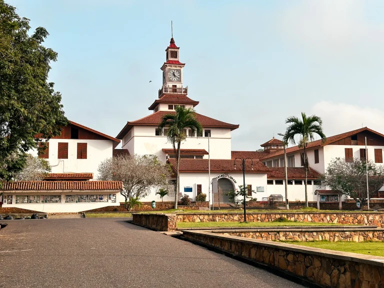
The University of Ghana, the country's premier tertiary institution, is located at Legon, on the outskirts of Accra.
Notable Places
Accra contains numerous landmarks that reflect its history, culture, and aspirations. These notable places are important destinations for visitors and significant sites for residents.
The Kwame Nkrumah Mausoleum, also known as the Kwame Nkrumah Memorial Park, is the last resting place of Osagyefo Dr. Kwame Nkrumah, the first President of Ghana. The park offers a space to relax while learning about the history of Ghana and is located directly opposite the Commission for Human Rights and Administrative Justice.
Jamestown and Usshertown are historic communities that originated around the 17th-century British James Fort and Dutch Ussher Fort. The area features a whitewashed lighthouse that offers views of the city and the fishing harbor. The community is located directly east of the Korle Lagoon.
The National Theatre, built and offered as a gift to Ghana by China in 1990 and opened in 1992, is a distinctive cultural landmark. The design of the structure was inspired by African arts, featuring abstract mosaic murals and sculptures evoking power and feeling. It is located on South Liberia Road.
The Octagon is a business and retail center in the heart of Accra. The building complex offers approximately 75,000 square meters of usable area for luxury offices and retail, including a five-star hotel. It was opened in 2013 and is located at Tudu, a suburb of Accra, near Independence Avenue and Barnes Road, north of the Kinbu Gardens.
The Brazil House, located on Brazil Lane in the Ga Mashie area, is the most expressive material symbol of the Tabon people, the Afro-Brazilian returnee community in Ghana. The Tabom community is the only representative group of Afro-Brazilian returnees known in Ghana.
Black Star Square, also known as Independence Square, is a major public space in Accra. It hosts national events, including celebrations and public gatherings. The square is part of the legacy of Kwame Nkrumah's vision for Accra as a city that inspires pride and nationalism.
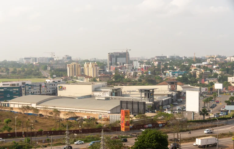
Other notable landmarks include the Holy Trinity Cathedral, the Ghana National Mosque, and Labadi Beach. The city's architecture reflects its layered history, ranging from 19th-century colonial buildings to modern skyscrapers and apartment blocks.
Related Entries