
The Upper West Region occupies the northwestern corner of Ghana, a compact administrative area defined by its proximity to Burkina Faso, its distinct savannah landscape, and a cultural character shaped by several closely related ethnic groups. Created in 1983, the region was carved out of the former Upper Region and remained Ghana's youngest administrative region for 35 years until six new regions were created in 2018. For much of the post-independence period, it was also Ghana's least populous region, a position it held until the 2021 census when the newly created Ahafo Region recorded a smaller population.
Despite its small population and distance from the coast, the Upper West Region holds real significance in national life. It is the homeland of a former Ghanaian president, Dr. Hilla Limann, and of several prominent political and public figures. Its capital, Wa, is a historic trading town with deep links to trans-Saharan commerce, and the region's festivals, mosques, and wildlife sanctuaries draw visitors seeking an experience quite different from the forested south. This page provides an authoritative overview of the region's administration, people, economy, and attractions.
Location
Overview
The Upper West Region is one of Ghana's 16 administrative regions, located in the country's northwestern corner. It shares an international border with Burkina Faso to the north and west, and internal borders with the Upper East Region to the east and the Northern Region to the south. The region covers a geographical area of 18,476 square kilometers, which represents roughly 12.7 percent of Ghana's total land area, making it the seventh largest region in the country by size.
The region's creation dates to 1983, when it was established under the Provisional National Defence Council (PNDC) government led by then-Head of State Jerry Rawlings. The new region was carved out of the former Upper Region, the remainder of which became the Upper East Region. For about 35 years, the Upper West Region held the distinction of being Ghana's youngest region, until 2018 when the government of President Nana Addo Dankwa Akufo-Addo created six additional regions, bringing the national total to 16.
Administratively, the Upper West Region is divided into 11 districts and municipalities. Its capital and largest settlement is Wa, which also serves as the seat of the Wa Municipal Assembly. The region's location gives it potential for cross-border trade and bilateral relations with Burkina Faso, though its proximity to the border also exposes it to spillover effects such as bushfires, disease outbreaks, and cross-border crime.
Capital and Administration
The regional capital is Wa, the largest settlement in the Upper West Region. Wa functions as the political and administrative hub, hosting the Regional Coordinating Council (RCC) and serving as the headquarters of the Wa Municipal Assembly. The official website of the Upper West Regional Coordinating Council is www.uwrcc.gov.gh.
At the apex of the region's political and administrative structure is the Regional Coordinating Council, which coordinates, harmonizes, monitors, and evaluates the activities of the District Assemblies as well as government ministries, departments, and agencies operating in the region. The political head of the region is the Regional Minister, Hon. Charles Lwanga Puozuing Esq., who represents the central government.
The Upper West Region is divided into 11 Metropolitan, Municipal, and District Assemblies (MMDAs), comprising 5 Municipal Assemblies and 6 Ordinary (District) Assemblies. The five municipalities are Wa, Nandom, Sissala East, Jirapa, and Lawra. The six districts are Lambussie-Karni, Nadowli-Kaleo, Sissala West, Wa East, Daffiama-Bussie-Issa, and Wa West. Each assembly is administered by a Chief Executive who represents the central government, with authority derived from an assembly headed by a presiding member elected from among the assembly members themselves. The region also has 11 parliamentary constituencies, which cover the same territories as the MMDAs.
The district capitals, as confirmed by the Local Government Service, are as follows:
- Wa Municipal – Wa
- Jirapa Municipal – Jirapa
- Lawra Municipal – Lawra
- Sissala East Municipal – Tumu
- Nandom Municipal – Nandom
- Daffiama-Bussie-Issa – Issa
- Lambussie-Karni – Lambussie
- Nadowli-Kaleo – Nadowli
- Sissala West – Gwollu
- Wa East – Funsi
- Wa West – Wechiau
Population and Geography
According to the 2021 Population and Housing Census, the Upper West Region has a population of 901,502 people. This figure confirms the region's status as one of Ghana's least populous regions, though the 2021 census recorded the newly created Ahafo Region as the nation's least populous, a position Upper West had held in all previous post-independence censuses. The 2010 census recorded the region's population at 702,110, and projections based on a regional growth rate of 1.9 percent estimated a population of about 842,532 by 2019.
The region's population density is relatively low. The 2021 census recorded a density of 48.8 persons per square kilometer, making Upper West one of the most sparsely populated regions in Ghana, second only to the Savannah Region. There is, however, a marked concentration of population along the western corridor, where density can exceed 97 persons per square kilometer, particularly in the Lawra, Jirapa, and Nadowli areas. The Sissala East and Sissala West districts have the lowest densities, at about 11 persons per square kilometer.
Geographically, the Upper West Region lies at latitude 9.8° to 11.0° North and longitude 1.6° to 3.0° West. The region's terrain is generally between 275 and 300 meters above sea level, rising above 300 meters east of Wa and falling to about 150 meters further eastward. The region experiences two marked seasons: a wet season brought by south-western monsoon winds from the Atlantic Ocean, typically lasting from May to September, and a long dry season brought by north-eastern trade winds from the Sahara Desert, lasting from October to April. Temperatures can reach 41°C in March and April, just before the onset of the rains. Mean annual rainfall varies between 840mm and 1,400mm, often falling in heavy downpours that encourage run-off rather than soil moisture retention.
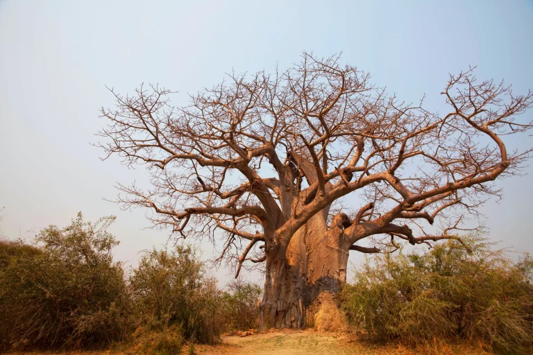
The region lies within the Guinea Savannah ecological zone, characterized by short, fire-resistant trees interspersed with grass that shed their leaves in the dry season. Common tree species include the baobab, kapok, parkia, and the economically valuable sheanut tree, alongside introduced species such as neem and eucalyptus.
Major Towns
Wa is the dominant urban center in the Upper West Region, serving as the regional capital and largest settlement. Estimates from the 2010 census placed Wa's population at approximately 100,000. The town is a historic trading center with a notable concentration of mosques, reflecting its long connection to trans-Saharan trade routes.
Tumu, the capital of the Sissala East Municipal District, is the second most developed settlement in the region, with an estimated population of 15,000. Other significant towns include Jirapa (estimated population 16,000), Lawra (14,000), Nandom (7,000), Nadowli (7,000), and Hamile (6,000), based on estimates from the 2010 census. These towns serve as district capitals and local commercial centers, each with its own administrative, educational, and health infrastructure.
The region contains 1,152 communities in total. Settlement patterns vary among ethnic groups: the Dagaaba and Birifor tend to have scattered settlements, while the Sissala, Waala, and Chakali typically live in nucleated (clustered) settlements. The dispersed nature of rural settlement poses challenges for the provision of basic services such as water and electricity.
Languages and Culture
English is the official language of Ghana and is used for official and administrative purposes throughout the Upper West Region. In everyday life, however, the region is linguistically diverse, with several local languages spoken across different communities. The predominant languages include Dagaare, Sisaali (Sisaala), Waali (Wali), Birifor, Lobi, Vagla, and Chakali.
The Upper West Region is inhabited predominantly by three major ethnic groups: the Wala, the Dagaba (Dagaaba), and the Sisaala. The Wala people are concentrated in Wa and nearby villages and are predominantly Muslim. The Dagaba occupy the western part of the region, while the Sisaala live in the eastern areas. The Sisaala and Dagaba are mostly Christian or follow traditional religious practices. The Wala speak Waali, while the Dagaba speak Dagaare.
Traditional governance remains important in the region. Wa has a council of chiefs known as the Waala Traditional Council, composed of several chiefs and government appointees. The council is led by the Overlord of the Waala Traditional Area, a position historically held by the Wa Naa. The Wa Naa's Palace, a 16th-century structure showcasing Sudanese architecture, remains one of the region's most significant cultural landmarks.
Festivals are integral to cultural life in the Upper West Region, marking agricultural seasons, historical events, and religious observances. Notable festivals include the Dumba Festival (known as Damba elsewhere in Ghana), celebrated by the Wala people in Wa; the Kobine Festival in Lawra; the Kakube Festival in Nandom; and the Paare-gbeile (Paragbiele) Festival celebrated by the people of Tumu. The Dumba Festival includes a ritual assessing the chief's fitness to rule, marked by a daring leap over a tethered cow. The Paragbiele Festival showcases local produce and features music and dance in gratitude for agricultural blessings. Other festivals in the region include the Damba, Dumba, Paaragbiele, Kobine, Kakube, Gologo/Golib, Fao, Kalibi, Samanpiid, Feok, Adaakoya, Kuure, Tengana, and Boaram festivals.
The region is also known for its craftsmanship, including spinning, weaving, pottery, and musical instrument production, which are often highlighted during local festivals. The distinctive local architecture features rectangular mud houses, adapted to the regional climate, in contrast to the round huts more common in the Upper East Region.
Economy
Agriculture is the dominant economic activity in the Upper West Region, reflecting the region's Guinea Savannah ecology. Mixed farming is the norm, with crops including maize, millet, guinea corn, groundnuts, beans, cowpea, yam, cassava, and a little sweet potato. Yam and cassava are mainly cultivated in the southern half of the region. Vegetables commonly grown include okra, pepper, and cassava leaves. The region's tree crops include the sheanut tree, which produces shea nuts used in food and cosmetics.
Livestock rearing is also significant, with cattle, sheep, and goats being the predominant animals raised. Guinea fowl is the main poultry in the region, and sheep, goats, chickens, pigs, and guinea fowl are raised for meat and eggs. The region's long dry season, extending roughly from October to May, limits agricultural activity for much of the year. As a result, many people leave the region to work in the southern part of Ghana for at least part of the year, a seasonal migration pattern that has shaped the region's economy and society.
The region's location on Ghana's northern border gives it potential for international and inter-regional trade and other bilateral relations with Burkina Faso. However, the overspill of criminal activities and disasters, such as bushfires, diseases, pestilence, and armed robbery from neighboring countries, also poses a threat to the region's stability and development.
Landmarks and Tourism
The Upper West Region, despite its small size, offers a range of tourist attractions spanning wildlife, history, and architecture. The region's history as a major route for trans-Saharan trade is evidenced by numerous mosques in Wa, including the ancient Sudanese mosques in Nakore and Dondoli. These structures reflect centuries of commercial and cultural exchange across the Sahara.
The Wechiau Hippopotamus Sanctuary is one of the region's most notable attractions. Located southwest of Wa, along the Black Volta River in the Wa West District, the sanctuary is a community-based eco-tourism project that preserves wildlife along a stretch of the river. It offers visitors the opportunity to see hippopotamuses in their natural habitat, including unique experiences such as staying at the Hippo Hide Tree House. The sanctuary is located approximately ten kilometers west of Wechiau.
The Gwollu Slave Defence Wall in the Sissala West District is a significant historical site. Built to protect locals from slave traders, the wall stands as a reminder of the region's turbulent history during the slave trade era. Gwollu is also the hometown of Dr. Hilla Limann, who served as President of Ghana from 1979 to 1981. Ancient caves in Bulenga, Dahili, and Sankana served as refuges during slave raids, and the region also features slave camps and a market in Kassana.
The Gbelle Game Reserve, located south of Tumu, is a notable wildlife habitat. The reserve is home to various species, including endangered birds and large herds of roan antelope. The Gbele Resource Centre borders the Daffiama-Bussie-Issa, Sissala West, and Sissala East districts. The Ambalaara Forest Reserve is located in the Wa East District.
The 16th-century Waa Naa's Palace in Wa, showcasing impressive Sudanese architecture, is another key attraction. The palace serves as the residence of the Wa Naa, the traditional ruler of the Wala people, and is a testament to the region's rich architectural heritage. Other attractions include the Nakore Ancient Mosque and the Wa Naa's Palace, both of which draw visitors interested in the region's history and culture.
For accommodation, there are numerous hotels and guest houses in Wa and other district capitals. The largest hospitality facility in the region is the Royal Cosy Hills, located in Jirapa.
Related Entries
Northern Region
Ghana-related region discovered through the border region relationship for Upper West Region.
Continue Reading →Search the Ghana Knowledge Database
Sources
- UPPER WEST – LOCAL GOVERNMENT SERVICE
- Upper West Region - Wikipedia
- Upper West Region – Visit Ghana
- 2021 Population and Housing Census - Ghana Statistical Service
- Upper West Region - Community Water and Sanitation Agency
- 2021 Population and Housing Census provisional results - Upper West Region | NCCE Ghana
- census2021.statsghana.gov.gh
- uwrcc.gov.gh
- en.wikipedia.org