

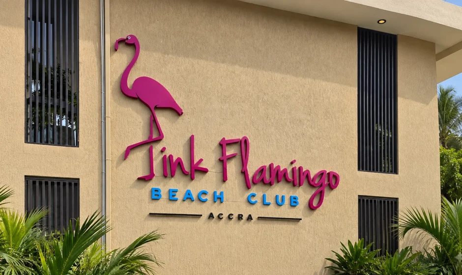

The demolition of Pink Flamingo Lounge and other structures at Laboma Beach has become a major dispute over flood prevention, waterfront development and employment in Accra.
Ghana’s Post Flood Mitigation Task Force began the operation on September 13, 2026. The government says it removed specifically identified structures built within the protected buffer and water-retention area of the Kpeshie Lagoon. It argues that years of vegetation loss, filling and construction have reduced the lagoon’s ability to hold floodwater and contributed to flooding in nearby communities.
Laboma Beach Board Director Daniel M.K. Okpoti disputes parts of that account. He says officials went beyond an agreed demolition boundary and claims that more than 3,000 people depend on businesses in the enclave for their livelihoods. That employment figure has been widely reported, but it is a claim from the Laboma Beach director and has not been supported publicly by an independently verified worker register.
This guide separates the confirmed facts from the contested claims, explains what a lagoon buffer zone does and outlines the documents and questions that matter when a business faces planning or environmental enforcement in Ghana.
- The operation began at Laboma Beach on September 13, 2026.
- Pink Flamingo Lounge was among the structures demolished.
- The Presidency says REGSEC ordered occupants in the identified buffer area to leave within 21 days after an August inspection.
- The government says the operation was limited to marked structures and was not a demolition of the entire Laboma Beach enclave.
- A Laboma Beach director claims more than 3,000 livelihoods could be affected. The figure is not an official government count or independently audited total.
- The government says the cleared area will be dredged and ecologically restored with support from the Environmental Protection Authority and Forestry Commission.
Table of Contents
- What happened at Laboma Beach?
- Timeline of the demolition
- Why the government says the structures had to go
- What Laboma Beach management disputes
- Could 3,000 livelihoods be affected?
- What a lagoon buffer zone is
- The legal and planning questions
- What affected owners and workers can do
- What happens to the site next
- Frequently asked questions
What Happened at Laboma Beach?
In the early hours of Sunday, September 13, the Post Flood Mitigation Task Force and the Greater Accra Regional Security Council began removing structures in the Laboma enclave of the La Dade-Kotopon Municipality.
Pink Flamingo Lounge, a prominent beachfront entertainment venue, was among the affected properties. Authorities also removed other marked structures and a newly built wall along the Labadi-Teshie road.
The operation was led on the ground with support from the Ghana Armed Forces’ 48 Engineer Regiment. It formed part of a wider Greater Accra flood-mitigation campaign involving dredging, removal of obstructions and restoration of water-retention basins.
The government describes the affected land as part of the Kpeshie Lagoon’s former floodplain or water-retention basin. Officials say vegetation had been cleared and sections filled with sand, construction debris, solid waste and boulders to create land for development.
The demolition did not cover every business commonly described as being at Laboma. Task Force Chairman and Deputy Chief of Staff for Operations Stan Xoese Dogbe said structures outside the team’s marked work area were not touched because they fell outside its mandate.
Laboma Beach Demolition Timeline
| Date | Development | Why It Matters |
|---|---|---|
| August 6-7, 2026 | REGSEC inspected the Laboma Beach enclave and directed occupants in the identified lagoon-buffer area to vacate within 21 days. | This is the notice period cited by the government as preceding enforcement. |
| September 13, 2026 | The Task Force began demolishing Pink Flamingo and other marked structures. | The operation moved from notice and engagement to physical enforcement. |
| September 13, 2026 | Stan Dogbe said the operation was limited to identified structures needed for dredging and recovery of the retention basin. | This is the government’s answer to claims that all Laboma businesses were being removed. |
| September 13, 2026 | Daniel M.K. Okpoti alleged that officials crossed an agreed boundary and said more than 3,000 livelihoods could be affected. | These claims created the central boundary and employment disputes. |
| After the clearing | The government directed the EPA, Forestry Commission and regional authorities to prepare ecological restoration work. | The stated plan is to restore flood-retention capacity, not simply leave the cleared land vacant. |
Some reports describe the REGSEC directive as having been issued on August 7, while the Presidency’s formal September 13 release gives August 6. The important undisputed point is that authorities say a 21-day vacation notice followed the early-August inspection.
Why the Government Says the Structures Had to Go
The government’s case is based on the role of the Kpeshie Lagoon area as a floodwater pathway and retention basin.
A lagoon and its surrounding wetland can hold stormwater temporarily, slow runoff and provide space for water to move toward the sea. When vegetation is removed and low-lying land is filled, the same volume of stormwater has less room to spread and drain. That can push water into roads, homes and businesses elsewhere in the catchment.
The Presidency says a risk assessment by the Greater Accra Regional Coordinating Council linked conversion of the lagoon’s floodplain into commercial plots with serious flooding in the Tse Addo area during recent heavy rains. It says parts of the wetland were cleared, filled and sold for private development.
Regional Minister Linda Ohenewaa Akweley Ocloo said developers used heavy boulders, sand and other material to reclaim portions of the water body before construction. Dogbe separately said the affected filling reduced the basin’s storage capacity and obstructed the movement of water from upstream toward the sea.
These are official findings and explanations. A complete public technical record, including the full risk assessment, surveyed buffer coordinates and property-by-property enforcement file, was not included in the official release reviewed for this article. Publishing those materials would make it easier for the public and affected businesses to test the government’s boundary and flood-risk conclusions.
What Laboma Beach Management Disputes
Okpoti does not deny that authorities have a responsibility to address flooding. His objections concern the location of the water path, the extent of the demolition and its economic consequences.
He claims water from the Kpeshie Lagoon does not pass through the area where the demolished businesses stood. He has suggested that upgrading a bridge or other drainage infrastructure could address the problem without removing businesses.
He also alleges that the demolition continued beyond a point identified by the Greater Accra Regional Minister during her visit. Public reports reviewed for this article do not contain an independent survey confirming that allegation or a government admission that the operation exceeded its marked boundary.
| Issue | Government Position | Laboma Director’s Position | What Remains Unresolved Publicly |
|---|---|---|---|
| Demolition boundary | Only marked structures within the Task Force’s work area were removed. | Officials went beyond the point that had been agreed. | A published survey overlay showing the official line and each affected structure. |
| Water flow | Filling and construction reduced the lagoon basin’s retention and drainage function. | Water does not flow through the demolished business area. | The underlying hydrological study and site-specific engineering evidence. |
| Notice | Owners were alerted more than a month earlier and given a 21-day ultimatum. | Management’s public criticism focuses mainly on boundary and impact, not a single agreed account of every notice served. | Copies, service records and terms of each property-specific notice. |
| Employment impact | No official affected-worker total was stated in the reviewed government release. | More than 3,000 people depend on businesses in the enclave. | An independently verified breakdown of direct, contract and indirect jobs. |
The dispute cannot be resolved reliably from photographs or public statements alone. The decisive evidence would include surveyed coordinates, approved site plans, planning and building permits, environmental approvals, leases or licenses, enforcement notices and the hydrological basis for the marked boundary.
Could More Than 3,000 Livelihoods Be Affected?
The most widely repeated employment figure comes from Okpoti, who said businesses at Laboma Beach employ more than 3,000 people who depend on the enclave for income.
That is a serious claim, but it should be described accurately. It is not a figure announced by the Ghana Statistical Service, the Labor Department or another independent body. Public reporting reviewed for this article did not provide a payroll, tenant list or breakdown showing how the total was calculated.
The actual effect may include more than permanent employees. Beachfront entertainment and hospitality businesses can support security personnel, cleaners, cooks, servers, performers, drivers, event workers, vendors and suppliers. Some may work full time, while others are casual, seasonal, contracted or indirectly dependent on customer traffic.
That complexity is why three different numbers may be relevant:
- Direct jobs: workers formally employed by the demolished businesses.
- Associated work: contractors, vendors and service providers who regularly earned income from the enclave.
- Livelihoods affected: a broader estimate that may include households or people whose earnings fall because customer activity declines.
A credible impact assessment should separate those categories and identify which businesses were actually closed, which relocated and which continued operating outside the Task Force’s marked area. Until that information is published, “more than 3,000” should remain clearly labeled as the Laboma director’s estimate.
What Is a Lagoon Buffer Zone?
A buffer zone is land retained around a river, stream, lagoon, wetland or other water body to protect its ecological and drainage functions. Depending on the site, a buffer may help preserve vegetation, reduce erosion, filter pollutants, provide access for maintenance and leave room for floodwater.
Ghana’s Water Resources Commission has a national Riparian Buffer Zone Policy that supports protection and management of land adjoining water bodies. Land development is also governed through the Land Use and Spatial Planning Act, 2016 (Act 925), related regulations and the planning functions of local authorities.
There is no safe basis for a property owner to assume that one standard distance applies automatically to every lagoon site. The controlling line may depend on the type of water body, an approved local plan, environmental conditions, flood-risk studies and an official survey or demarcation.
This matters at Laboma because the public controversy concerns not only whether buffers are legitimate, but exactly where the protected Kpeshie boundary sits and which structures crossed it.
The Legal and Planning Questions Behind the Demolition
The public debate often reduces the issue to a single question: did the businesses own or lawfully occupy the land? That is important, but it is not the only legal question.
Land rights, planning approval, building approval and environmental permission are different layers. A person may hold a lease or other interest in land but still face restrictions on where and how the site can be developed. A business license also does not necessarily establish that a particular building complies with planning, structural or environmental requirements.
For each affected structure, a proper review would ask:
- Who granted the underlying land interest, and what exactly did the grant cover?
- Was the title, lease, license or allocation verified against the site coordinates?
- Was the land zoned or approved for the use being carried on?
- Were valid development and building permits issued for the specific structure?
- Did the permits include conditions relating to drainage, wetlands or setbacks?
- Was an environmental permit or assessment required and obtained?
- Which public body issued the enforcement notice, under what authority and to whom was it served?
- Did the demolished footprint fall within the officially surveyed buffer or retention basin?
- Was there an available objection, appeal or court process, and was it used?
It is also important to distinguish regulatory enforcement from compulsory acquisition. Compensation questions can differ depending on whether government is taking a valid private interest for a public purpose, enforcing planning law against an unauthorized development, clearing an encroachment or acting outside its lawful boundary. The facts and documents determine which legal framework applies.
Nothing in the public reporting reviewed here establishes a universal answer for every affected owner, tenant or worker. Anyone seeking compensation or challenging the process would need case-specific legal advice based on the notices, permits, land instruments and survey evidence.
What Affected Owners, Tenants and Workers Can Do
Affected parties should preserve evidence before documents, messages and site details become difficult to recover.
For property owners and business operators
- Collect the complete property file. Include leases, licenses, allocation documents, site plans, searches, receipts, permits, environmental correspondence and any renewal records.
- Preserve every notice. Keep the original document, envelope, delivery record, email, text message and photograph showing markings placed on the structure.
- Document the affected footprint. Preserve dated photographs, videos, inventory lists, equipment records and a survey showing the structure’s coordinates.
- Request the official basis in writing. Ask the relevant authority for the enforcement decision, plan or survey identifying the buffer boundary and the legal basis for the action.
- Separate land and permit questions. A title search does not replace verification of planning, building and environmental approvals.
- Obtain professional advice quickly. A Ghanaian lawyer and licensed surveyor can assess the notices, boundary and available review procedures. Legal time limits may apply.
- Record losses carefully. Keep payroll, tax, supplier, stock and revenue records. They may be important if a lawful claim or negotiated assistance process becomes available.
For employees and contractors
- Keep employment contracts, payslips, mobile-money payment records, staff identity cards and work schedules.
- Ask the employer in writing whether the business is relocating, suspending work or terminating employment.
- Request any outstanding wages and employment documents through a traceable channel.
- Where necessary, seek guidance from the Labor Department, a recognized union or a qualified employment lawyer.
- Do not rely on the 3,000-person estimate as proof of an individual claim. Each worker should preserve evidence of their own employment or income relationship.
These steps do not guarantee compensation or reversal. They create the factual record needed to understand what happened and evaluate any remedy that may exist.
What Future Waterfront Investors Should Learn From Laboma
The Laboma controversy is a warning for anyone buying, leasing or financing land beside a lagoon, wetland, drain, stream or coastline in Ghana.
Basic title verification is necessary, but waterfront due diligence should go further. A buyer should obtain a coordinate-based survey, confirm the planning designation with the relevant assembly, check for drainage reservations and protected buffers, verify all development permissions and ask whether filling or reclamation has changed the original character of the land.
Visible buildings nearby do not prove that a site is lawful or safe to develop. Long occupation, utility connections, tax payments and a functioning business can coexist with unresolved planning or environmental problems.
Prospective investors should also inspect the site during or shortly after heavy rain, speak with neighboring residents and review flood-risk information. Our guides to the Ghana land title verification process and reducing flood risk when choosing where to live provide useful starting points.
What Happens to the Kpeshie Lagoon Site Next?
The stated government plan is ecological restoration, not immediate redevelopment.
Dogbe directed the Greater Accra Regional Coordinating Council to work with the Environmental Protection Authority and Forestry Commission on restoring reclaimed sections. Announced measures include debris removal, dredging and planting coconut and other suitable trees.
The intended outcome is to return cleared land to a condition that can hold more floodwater, support vegetation and discourage renewed encroachment. The 48 Engineer Regiment has already been involved in dredging the Kpeshie Lagoon and in related interventions at the Tesa Dam and Lafa Water Retention Basin.
The long-term test will be measurable. Authorities will need to prevent new filling, maintain the restored basin, publish or clearly mark the protected boundary and show whether the work improves drainage during future storms. Without continuing enforcement and maintenance, cleared wetlands can be reoccupied or filled again.
There is also a public-accountability question. If the area is being recovered for flood protection, future commercial allocation or construction inside the same protected footprint would undermine the stated justification for the demolition. A transparent restoration plan, mapped boundary and periodic progress updates would help establish that the land remains dedicated to its environmental and drainage function.
Why the Laboma Dispute Matters Beyond One Beach
Accra’s flooding problem is not caused by one venue or one lagoon. It involves intense development, blocked drains, waste disposal, loss of wetlands, inadequate infrastructure and construction in natural water paths.
The Post Flood Mitigation Task Force has pursued interventions at several locations, including the Tesa Dam, Legon Boundary Road watercourse and Lafa basin. The Ghana Armed Forces says the task force’s mandate includes clearing unauthorized dumping areas and debris that obstruct the natural movement of water.
Laboma has become especially controversial because flood-control enforcement collided with a visible leisure and hospitality economy. That creates two legitimate public concerns: protecting communities from dangerous flooding and treating businesses, workers and property interests through a transparent, lawful process.
Those concerns do not have to cancel each other out. Strong environmental enforcement is more credible when boundaries are mapped, technical studies are available, notices are documented and similarly situated properties are treated consistently. Economic-impact claims are more persuasive when businesses publish verifiable employment and investment records.
Frequently Asked Questions
Was all of Laboma Beach demolished?
No. The government says the operation targeted identified and marked structures within the Task Force’s Kpeshie Lagoon work area. Dogbe said other structures and businesses were left untouched because they fell outside the operation’s scope.
Was Pink Flamingo demolished?
Yes. Multiple reports and the government’s account confirm that Pink Flamingo Lounge was among the affected structures on September 13, 2026.
Were occupants given notice?
The Presidency says REGSEC directed occupants in the identified area to vacate within 21 days after an early-August inspection. Whether every affected party received legally sufficient, property-specific notice is a separate question that depends on the individual enforcement records.
Did the demolition affect 3,000 jobs?
A Laboma Beach director said more than 3,000 people depend on businesses in the area. The number has not been independently verified or broken down publicly into direct employees, contractors, vendors and other affected livelihoods.
Does having a land title prevent demolition?
Not automatically. A land interest is different from permission to build or operate a particular development. Planning, building, environmental and drainage restrictions may still apply. The legality of any demolition also depends on the authority used, the boundary, notice and the facts of the individual case.
Will affected businesses receive compensation?
No general compensation program had been announced in the official materials reviewed for this article. Entitlement, if any, would depend on the legal status of the property interest, permits, the nature of the government action and whether the correct process and boundary were followed.
What will replace the demolished structures?
Authorities say the land will undergo ecological restoration to recover vegetation and floodwater-retention capacity. No official plan reviewed for this article announced replacement commercial development on the cleared footprint.
Sources
- The Presidency: “Kpeshie Lagoon Clearing Enters Enforcement Phase as Task Force Demolishes Illegal Structures at Laboma Beach” (September 13, 2026)
- Ghana Armed Forces: “GAF Supports Post Flood Taskforce With Equipment” (August 20, 2026)
- Water Resources Commission: Riparian Buffer Zone Policy 2013
- Land Use and Spatial Planning Regulations, 2019 (L.I. 2384)
- Citi Newsroom: “Pink Flamingo, Other Structures Demolished at Laboma Beach” (September 13, 2026)
- Citi Newsroom: “Laboma: Demolition Targeted Marked Structures Within Lagoon Buffer Zone” (September 13, 2026)
- Citi Newsroom: “Laboma Demolition: Over 3,000 Livelihoods Could Be Affected” (September 13, 2026)
- Citi Newsroom: “Laboma Demolition: Okpoti Accuses Authorities of Exceeding Agreed Boundary” (September 13, 2026)
- Citi Newsroom: “Kpeshie Lagoon to Undergo Ecological Restoration After Laboma Demolition” (September 13, 2026)