On April 14, 2026, Ghana officially declared the Greater Cape Three Points Marine Protected Area, the country’s first formally designated MPA. Covering 703.86 square kilometres of coastal waters in the Western Region, the reserve marks the start of a new chapter in how Ghana manages its ocean resources.
In plain terms, it means that one of Ghana’s most ecologically productive stretches of coastline now has legal protection. Certain zones will be closed to fishing entirely, while others will allow regulated activity. The communities living along that coast will co-manage the area alongside government and conservation partners.
For a country where 60% of the population depends on the ocean for food and income – according to research published in Conservation Letters – this is not a minor policy footnote. It is a structural shift in how Ghana is approaching food security, coastal livelihoods, and its long-term environmental commitments.
Why This Happened Now
The timing is not accidental. In June 2026, global leaders will gather in Mombasa, Kenya, for the Our Ocean Conference – the first time the event will be held on the African continent. Ghana’s declaration of the Greater Cape Three Points MPA ahead of that meeting positions the country as a credible voice in global ocean governance conversations, rather than a passive observer.
There is also domestic pressure. Ghana’s fisheries sector has been deteriorating for years. Overfishing, illegal fishing practices, coastal pollution, and the compounding effects of climate change have worn down what were once productive marine ecosystems. The government has already implemented seasonal fishing closures and a moratorium on new fishing licences. The MPA sits within that broader reform effort, and Ghana’s Ministry of Fisheries and Aquaculture framed it in exactly those terms when the declaration was made.
At the international level, the push to protect 30% of the world’s ocean by 2030 – known as the 30×30 target, agreed under the Kunming-Montreal Global Biodiversity Framework – has given countries a concrete benchmark to work toward. Ghana’s MPA is a direct contribution to that goal. The challenge is that, globally, only about 10% of the ocean currently has any formal protection, and effective enforcement is patchy even within that figure.
What the MPA Actually Covers
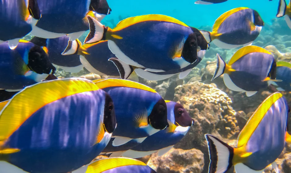
The Greater Cape Three Points area sits in Ghana’s Western Region and spans 703.86 square kilometres – roughly 272 square miles – of coastal and offshore waters. It was chosen deliberately. The area is one of Ghana’s most ecologically productive stretches of coastline, driven by natural upwelling currents that bring nutrient-rich water to the surface and create ideal conditions for marine life to breed and feed.
Fish species including sardinella, anchovy, and mackerel use the area as breeding and nursery grounds. The surrounding coastal wetlands and mangroves add another layer of ecological value – they protect shorelines from erosion, absorb carbon, and provide habitat for juvenile fish that eventually populate wider waters.
| Detail | Specification |
|---|---|
| Official name | Greater Cape Three Points Marine Protected Area |
| Declaration date | April 14, 2026 |
| Location | Western Region, Ghana |
| Area covered | 703.86 sq km (approx. 272 sq miles) |
| Communities affected | 21 coastal communities |
| Key species protected | Sardinella, anchovy, mackerel |
| Zoning type | Core (no-take) zones and multiple-use zones |
| Managing authority | Ministry of Fisheries and Aquaculture (co-managed with communities) |
The Sardinella Crisis Behind the Decision
If one statistic captures why this MPA was needed, it is this: over the past two decades, Ghana has seen a 71.5% decline in sardinella catch in its coastal waters, according to the Ministry of Fisheries and Aquaculture. That is not a gradual drift. It is a collapse in the availability of a fish that has historically been one of the most affordable sources of protein in the Ghanaian diet.
Sardinella – known locally as sardine or herrings – is smoked, dried, and traded by processors operating out of fishing communities along the coast. Women make up the majority of those processors. As catches have dropped, the economics of the trade have deteriorated with them. Smaller volumes mean higher prices, which price out lower-income households that depended on the fish as a cheap protein staple. The food security and gender equity implications run together.
The causes are layered. Overfishing is the most direct – too many vessels, too few restrictions, for too long. Illegal and unreported fishing has compounded the problem. So has the use of destructive fishing gear that damages the seabed and disrupts breeding habitats. Climate change adds another variable, with warming sea temperatures and shifting currents altering where and when fish aggregate. None of these pressures will disappear overnight. But removing a core breeding area from exploitation is a defensible starting point.
How the Zoning System Works
The MPA is structured around two types of zones. Core zones are fully protected – no fishing, no extraction. These cover the most sensitive habitats: breeding grounds, nursery areas, mangrove systems. The aim is to allow fish stocks in those areas to recover without ongoing disturbance.
Multiple-use zones sit around the core areas and allow regulated fishing and community activity under defined rules. The idea is that a fully recovered fish population within the core zones will spill outward over time, replenishing stocks in surrounding waters. It is the same logic applied in marine reserves elsewhere in the world, and the evidence from comparable projects – in West Africa and further afield – suggests it can work when enforcement holds.
Enforcement is where many MPAs fail. The government has committed to stronger monitoring and action against illegal fishing within the designated area. Scientific monitoring will run alongside enforcement to track whether fish populations are actually recovering. Without both, the designation risks becoming a line on a map with limited real-world effect. Ghana’s track record on fisheries enforcement has been mixed, as the country’s own reporting on illegal resource extraction in other sectors reflects – but the co-management model with coastal communities is a meaningful attempt to close that gap.
What It Means for Coastal Communities
The 21 communities within and around the MPA boundary were involved in the design process, not just notified after the fact. That distinction matters. Community-led conservation tends to last longer and generate better outcomes than top-down designations that communities feel no ownership over.
In practice, co-management means local fishers, processors, and community leaders will have a formal role alongside government and conservation partners in setting rules, monitoring compliance, and reporting violations. Their proximity to the water makes them more effective monitors than any government agency operating from a distance.
For those communities, the short-term adjustment will involve constraints – some fishing areas will be off-limits entirely. That is a real cost for households that depend on daily catches. The projected long-term benefit is a more stable and abundant fishery once stocks recover. The Ministry of Fisheries and Aquaculture has also flagged ecotourism as a potential supplementary income stream as biodiversity in the area rebounds.
What the MPA does not address directly is the broader poverty context of many Western Region fishing communities. Conservation gains and economic gains do not automatically translate into each other. The communities bearing the short-term constraints will need visible, tangible support to make the transition sustainable.
Ghana’s Place in the Global 30×30 Push
The global target is to protect at least 30% of the world’s ocean by 2030. The United Nations has noted that around 60% of the world’s marine ecosystems are already degraded or used unsustainably – a figure that gives the urgency of the 30×30 commitment some concrete grounding.
Ghana’s MPA is a small percentage of its total maritime territory, but it is a first formal step. For a country that previously had no designated marine protected area at all, going from zero to one is the threshold moment. The government has explicitly framed it as the start of a broader national ocean protection strategy, not a one-off measure.
At the Our Ocean Conference in Mombasa, Kenya, in June 2026, Ghana will be among the countries expected to announce or demonstrate ocean commitments. Having a recently declared, formally gazetted MPA – with a defined management structure and community co-governance component – gives Ghana a credible position in those discussions. West Africa as a whole has historically been under-represented in marine conservation commitments relative to the importance of the Gulf of Guinea to regional food systems.
What Comes Next
Designation is the beginning, not the achievement. The real test will come in enforcement and monitoring over the next several years. Key questions to watch include whether core zone boundaries are respected by fishing fleets, whether the co-management framework stays functional as priorities shift, and whether fish stock surveys show measurable recovery within the protected areas.
Ghana’s fisheries sector is also still operating under a broader reform agenda – the moratorium on new fishing licences, seasonal closures, and restrictions on destructive gear are all part of the same picture. The MPA’s success will be shaped partly by whether those adjacent measures hold.
For investors and diaspora members thinking about Ghana’s coastal economy – fishing, aquaculture, seafood processing, ecotourism – the MPA is a policy signal worth tracking. It suggests the government is moving toward tighter regulation of ocean resources, which will reshape opportunity structures in coastal communities over the medium term. Those interested in Ghana’s broader investment and resource landscape can also explore the Ghana agriculture investment guide for related context on how natural resource sectors are being reshaped by policy.
Sources
- Mongabay: “With its first marine reserve, Ghana protects its ocean to secure its future” – Emelia Arthur, Minister for Fisheries and Aquaculture (May 4, 2026)
- Mongabay: “Ghana declares its first marine protected area” (April 2026)
- United Nations: “Ocean Impacts” – Climate Change Resource Page
- Selig et al. (2019): “Mapping global human dependence on marine ecosystems” – Conservation Letters, Vol. 12(2)
- Our Ocean Conference 2026 (Mombasa, Kenya)